ACOM Involvement in FIREX-AQ 2019
TOGA-TOF instrument on the NASA DC-8.
Click for larger image.
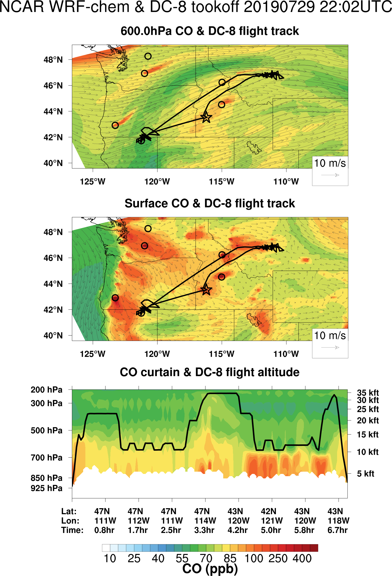
WRF-Chem Flight Track tool.
Click for larger image.
TROPOMI observes Siberian fire plumes.
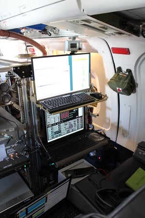
NOAA and NASA are the Principal Investigators for the FIREX-AQ field campaign. NCAR/ACOM provides instruments that measure the composition of gases within the smoke plumes through which the DC-8 research aircraft flies. These instruments have an intake mounted through the window panel of the DC-8 (see photo at the FIREX-AQ home page). A corresponding instrument mounted on a rack inside the aircraft analyzes the gas and collects data. Many instruments require a human operator to sit facing the monitor and track these measurements during flight.
Platforms
- NASA DC-8 aircraft.
- ER2 aircraft.
- Two Twin Otter aircraft.
- Aerodyne van (ground).
Instruments
- TOGA-TOF: Eric Apel, Alan Hills, Becky Hornbrook.
The TOGA-HR-TOF (Trace Organic Gas Analyzer High Resolution Time-of-Flight mass spectrometer) is flying on the NASA DC8 for the NASA/NOAA FIREX-AQ experiment. The most recent ACOM instrument, supported by NSF and developed by the ACOM VOC Measurements Group (Eric Apel, Alan Hills, and Rebecca Hornbrook) has been completed and is now collecting data on western wildfire smoke during August and prescribed burns in the Southeast U.S. during August and early September 2019. - CAFS: Sam Hall, Kirk Ullmann.
- NOx and O3: Andy Weinheimer, Deedee Montzka, Geoff Tyndall, Frank Flocke.
- Engineering: Steve Sherz, Steve Gabbard, Andy Watt.
Flight planning takes place every morning during the field campaign. A team of expert meteorologists, atmospheric chemists, modelers, and aviation experts examine the projected chemical weather for the day. They take into account the prevailing winds, the distance from Boise to active fires, the air and ground temperature, the weather forecast, and the flight capabilities of the NASA DC-8. Several chemical models (listed below) calculate the concentrations of various gases at 43 altitudes across the western United States. Together the team develops a flight plan for that will yield the best scientific value for the missin. The aircraft pilots are responsible for the safety of the research flight.
Chemical Forecasts
- Models: WRF-Chem, WACCM, FLEXPART.
- Team Boise: Louisa Emmons, Siyuan Wang, Ben Gaubert, Becky Schwantes, Rebecca Buchholz, Wenfu Tang, Louisa Emmons, Christoph Knote (LMU).
- Team Boulder: Gabi Pfister, Rajesh Kumar, Carl Drews, Garth D'Attilo, Shawn Honomichl.
Computer models of atmospheric chemistry run every night on the supercomputer in Cheyenne, Wyoming (NWSC). These models simulate chemical processes and emissions from active wildfires. The WRF-Chem regional model runs at the highest grid resolution (12 km with 43 vertical levels), and can track plumes of smoke spreading across the western United States.
Satellite Observations
MOPITT, IASI and TROPOMI CO: Helen Worden, Sara Martinez-Alonso, Gene Francis, Merritt Deeter, Dan Ziskin.
Massive Smoke Plume from Siberian Fires Reaches North America. A continental-scale plume of carbon monoxide (CO) and other air pollutants from active fires in Siberia is being mapped in near real-time by ACOM scientists, based on data provided by TROPOMI (the TROPOspheric Monitoring Instrument, on board ESA's Sentinel-5P platform). Read more...
Contact
Please direct questions/comments about this page to: