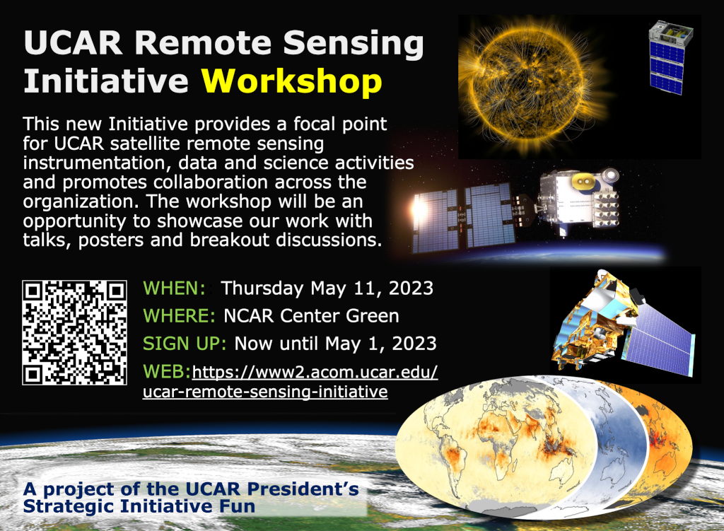
Workshop
Thank you for attending!
Please provide your feedback on the workshop here
The PSIF Remote Sensing Initiative workshop was held at UCAR Center Green on May 11. This was motivated by the Initiative objectives:
- To provide a focal point for all the satellite remote sensing instrumentation, data, science, application and outreach activities that we have across UCAR.
- To develop cross-organization communication, ideas and coordination, and promote the integration of satellite data within our Earth system science activities.
- To allow us to effectively and successfully respond to external remote sensing project opportunities, and by increasing our visibility, to be more often seen and approached as a potential collaborator.
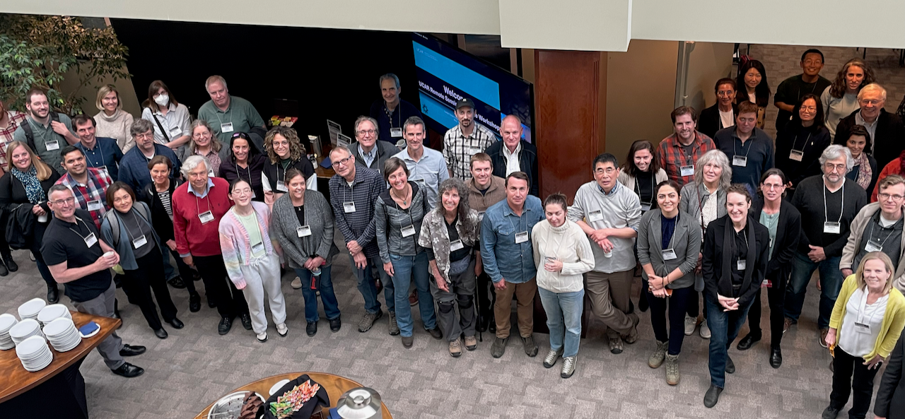
Workshop participants
This first workshop was primarily intended for UCAR staff and in-person participation was encouraged. The large workshop registration of 137 people (119 in-person, 18 virtual and 28 posters) indicates the high level of interest in remote sensing science across UCAR/NCAR/UCP. It was an excellent day, and the organizers received a lot of positive feedback about how useful and interesting the attendees found the workshop. We would like to thank everyone who participated with great presentations and engagement, UCP/CPAESS for excellent organization, CG multimedia for keeping everything smoothly on-track, Event Services for keeping us well-refreshed, and the UCAR President's Office for the support of this Initiative.
Some high-level takeaways from the workshop include:
- It is clearly an exciting time for satellite and ground-based remote sensing technology, missions and experiments, integration of data into Earth system analysis and modeling, and the development of new applications with education and outreach.
- We saw many interesting presentations and posters that demonstrate the breadth and depth of remote sensing expertise within the organization, and our extensive partnerships with other research and operational organizations.
- The workshop illustrated our remote sensing capabilities and strategic goals, and initiated new connections among the Labs and Programs to promote additional collaboration on future proposals and projects.
- Building on the presentations and discussions of the workshop, the next step for the Initiative will be a concept paper to define an organizational framework to continue after this PSIF phase and provide remote sensing coordination across UCAR for the workshop’s four connected themes: (1) Vision for the next generation of remote sensing observations; (2) Cross-organization collaboration in remote sensing; (3) Actionable science; and (4) Education and outreach.
- The concept paper will address where we are now, upcoming opportunities, challenges, ways in which UCAR units could contribute or benefit from an ongoing Remote Sensing Initiative, and where we would like to be in 5-10 years.
If you are not already actively involved in the Initiative and would like to be, please indicate on the workshop feedback form!
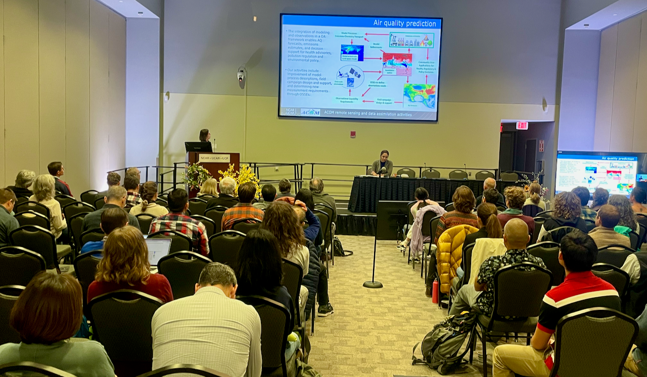
Helen Worden (ACOM) presenting and Shima Shams (RAL) chairing the Remote Sensing Activities Summary Talks
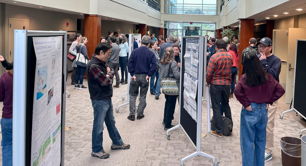
Poster discussions
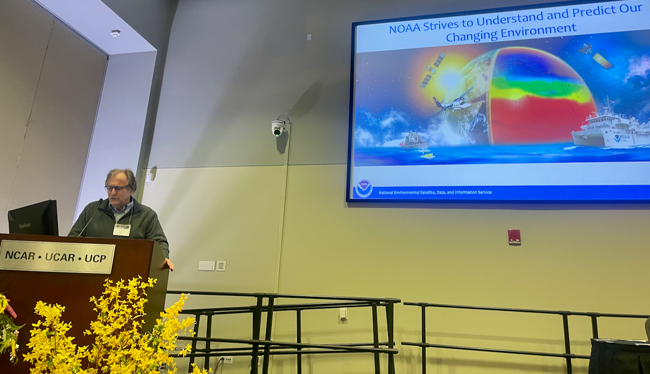
Mitch Goldberg (NOAA) presenting an agency perspective
Link to Agenda PDF
Link to Presentation File PDFs
Link to workshop full-day recording
PSIF Remote Sensing Workshop, May 11 2023, Agenda
| Time (MT) | Activity | Presenter/Facilitator | Chair | Rapporteurs | Location | |
|---|---|---|---|---|---|---|
| 0 | 8:00 | Coffee, refreshments | CG1 Lobby | |||
|
1
|
8:30 | Opening Remarks from UCP and NCAR and Workshop Logistics | Bill Kuo, Pieternel Levelt, David Edwards | CG1 Auditorium Center | ||
|
2
|
Remote Sensing Activities Summary Talks | Shima Shams | Mic: Wenfu Tang; Zoom monitor: Rebecca Buchholz | CG1 Auditorium Center | ||
|
3
|
8:40 | JCSDA | Tom Auligne | |||
|
4
|
9:00 | COSMIC | Jan-Peter Weiss | |||
|
5
|
9:20 | ACOM | Helen Worden | |||
|
6
|
9:40 | CGD | Christina McCluskey | |||
|
7
|
10:00 | CISL | Jeff Anderson | |||
|
8
|
10:20 | Break & Refreshments | CG1 Lobby | |||
|
9
|
Remote Sensing Activities Summary Talks ... continued | Qian Wu | Mic: Wenfu Tang; Zoom monitor: Rebecca Buchholz | CG1 Auditorium Center | ||
|
10
|
10:45 | EOL | Carol Ruchti | |||
|
11
|
11:05 | HAO | Roberto Casini | |||
|
12
|
11:25 | MMM | Jake Liu | |||
|
13
|
11:45 | RAL | Shima Shams | |||
|
14
|
12:05 | Poster Lightning Talks | Poster presenters | |||
|
15
|
12:30 | Buffet Lunch and Poster Session | CG1 Lobby | |||
|
16
|
Agency Perspectives | Pieternel Levelt | CG1 Auditorium Center | |||
|
17
|
13:30 | NASA | Barry Lefer | |||
|
18
|
14:00 | NOAA | Mitch Goldberg | |||
|
19
|
14:30 | Discussion Sections | Holly Gilbert | CG1 Auditorium Center | ||
|
20
|
Theme #1 - Vision for the next generation of remote sensing observations: What are the limitations of existing observations and the requirements of the next generation of observations that would help address challenging research questions? |
John Braun and Paul Bryans | Hannah Huelsing | CG1 Auditorium Center | ||
|
21
|
Theme #2 - Cross-organization collaboration in remote sensing: How can we build closer connections, what are the challenges and the best practices? |
Helen Worden and Kevin Raeder | Ivan Ortega | CG1 Auditorium North | ||
|
22
|
Theme #3 - Actionable science: How do we take intentional steps toward more actionable science for the next generation of proposal development and research? |
Olya Wilhelmi and Rajesh Kumar | Forrest Lacey | CG1 Auditorium South | ||
|
23
|
Theme #4 - Education and outreach: How might remote sensing experts expand their network of collaborators to develop meaningful collaborations with various education audiences including K-12 schools, and informal science education organizations? |
Becca Hatheway and Grace Crain-Wright | Chris Davis | CG1 2126 | ||
|
24
|
15:30 | Break & Refreshments | CG1 Lobby | |||
|
25
|
16:00 | Discussion group outbriefs (10 min each); next steps and wrap-up (20 min) | Discussion Section Rapporteurs | David Edwards and Jan-Peter Weiss | Zoom monitor: Shima Shams | CG1 Auditorium Center |
|
26
|
17:00 | Reception and Poster Session | CG1 Lobby | |||
|
27
|
18:30 | Adjourn |