ACOM News
Pieternel Levelt receives Snellius Medal
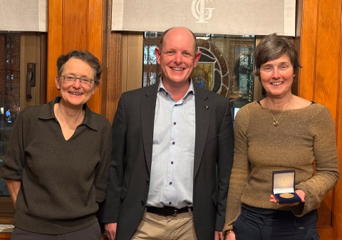
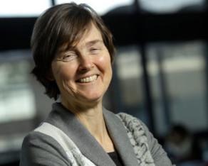
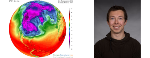
On March 13, Pieternel Levelt (far right), an associate director of the U.S. National Science Foundation National Center for Atmospheric Research (NSF NCAR), received the 2026 Snellius Medal. The Snellius medal is a prestigious award that is only given once every ten years by the Dutch Society for the Promotion of Natural Sciences, Medicine, and Surgery.
Wildfires that burn buildings create significantly more air pollution
A research team led by the U.S. National Science Foundation National Center for Atmospheric Research (NSF NCAR) has published a foundational inventory of emissions produced by structures destroyed by fires in the wildland-urban interface (WUI).

NASA selects STRIVE explorer for next phase
NASA has selected The Stratosphere Troposphere Response using Infrared Vertically-resolved light Explorer (STRIVE) to move to the next phase of development. A team at the U.S. National Science Foundation National Center for Atmospheric Research (NSF NCAR) contributed to the project.
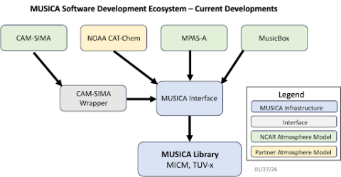
Demonstrating MUSICA in 3d Modeling
For the past several years, the MUSICA software engineering team has been creating a software library that represents atmospheric chemistry processes in a model independent and runtime configurable fashion so that MUSICA can interface with any atmosphere model. In the January 2024 newsletter, we showed this vision for MUSICA software development; a simplified version of the schematic is repeated in Figure 1.
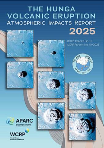
International Report Unveils the Global Atmospheric Impacts of the 2022 Hunga Volcano Eruption
The Hunga Volcanic Eruption Atmospheric Impacts Report, a landmark international scientific assessment, has been released today under the Atmospheric Processes and their Role in Climate (APARC) project of the World Climate Research Programme (WCRP).
The authors are pleased to see how well WACCM does at simulating Hunga impacts, and Hunga has become a benchmark for evaluating global chemistry-climate models.
Pieternel Levelt selected as member of Royal Netherlands Academy of Arts and Sciences
Pieternel Levelt, an associate director of the U.S. National Science Foundation National Center for Atmospheric Research (NSF NCAR) has been selected as a member of the Royal Netherlands Academy of Arts and Sciences (KNAW).
KNAW announced this week that it had selected Levelt and 16 other members from a large number of nominations by expert juries in each scientific and scholarly field. They will be officially installed on September 29, 2025.
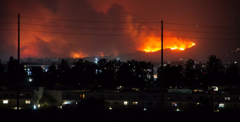
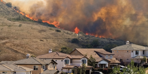
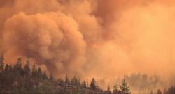
Smoke from wildland-urban interface fires more deadly than remote wildfires
The smoke from fires that blaze through the wildland-urban interface (WUI) has far greater health impacts than smoke from wildfires in remote areas, new research finds.
The study, published this week in Science Advances, estimates that emissions from WUI fires are proportionately about three times more likely to lead to annual premature deaths than emissions from wildfires in general. This is because the fires, and their associated emissions, are far closer to populated areas.
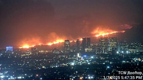
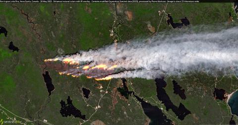
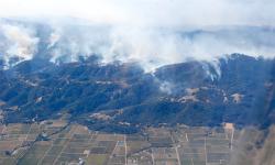
Satellite Images Show Areas in California Wildfires Miraculously Spared
The Pacific Palisades fire, the most destructive wildfire in Los Angeles history, has scorched nearly 20,000 acres, according to CAL FIRE's latest figures, but as the images show, some areas of land and structures have managed to escape the flames.
Frank Flocke, a senior scientist at NSF National Center for Atmospheric Research (NCAR), told Newsweek: "The variability of winds on a fine scale due to terrain or obstacles" could be part of the reason some areas of vegetation have avoided being burned.
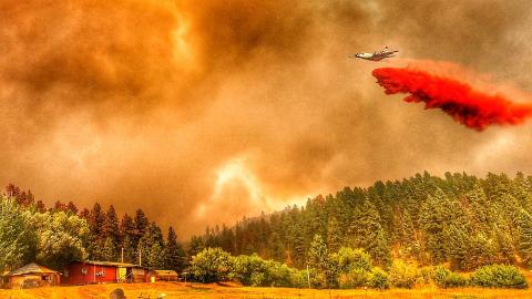
How wildfire smoke, retardant slurry impact human health, environment
While flames may be the most visual wildfire danger, experts say smoke and fire retardant slurry can have long-lasting effects on human health and the environment.
“There are hundreds of gases that are emitted from wildfire smoke, some of them in very, very small quantities,” National Center for Atmospheric Research scientist Rebecca Hornbrook said. “Some — like carbon monoxide, carbon dioxide and nitrogen oxides — are emitted in higher quantities, but some of those smaller quantity gases are actually even more toxic.”
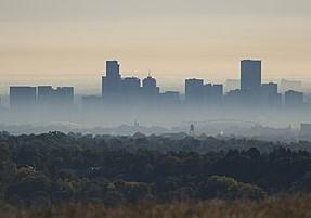
Researchers look into the health impacts of wildfire smoke
Wildfire smoke has become an increasingly significant source of air pollution, raising concerns about its impact on public health. As massive fires rage across forests and grasslands, they release large quantities of fine particulate matter (PM2.5), a dangerous pollutant that can penetrate deep into the lungs. Prolonged exposure to these tiny particles has been linked to a range of health problems, including respiratory and cardiovascular issues, making wildfire smoke a growing threat, especially in regions prone to intense fire seasons.
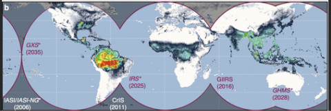
Coordinated Geostationary, Multispectral Satellite Observations Are Critical for Climate and Air Quality Progress
Satellite observations are critical for air quality and climate monitoring, and for developing the process understanding needed for reliable planning and predictions. Our current space-based observing system stands at a crossroads with the early missions approaching their end-of-life. We articulate the challenges and needs to sustain and develop these environmental records into the future, focusing specifically on observations of gas-phase atmospheric composition.

Scientists propose guidelines for solar geoengineering research
Scientists for several years have studied the theoretical effectiveness of injecting sulfur dioxide into the stratosphere to reflect heat from the Sun and offset Earth’s warming temperatures. But they also want to ensure that the solar geoengineering approaches being studied are evaluated for their technical feasibility, as well as their cooling potential and possible ecological and societal side effects.
Artificial climate control might become ineffective
One regional geoengineering proposal for alleviating the extreme heat effects of global warming, the brightening of marine clouds to reflect more solar energy to space over different limited areas, could work in present-day conditions but may become ineffective in the future, according to new research.

Asian Monsoon Lofts Ozone-Depleting Substances to Stratosphere
Powerful monsoon winds, strengthened by a warming climate, are lofting unexpectedly large quantities of ozone-depleting substances high into the atmosphere over East Asia, new research shows.

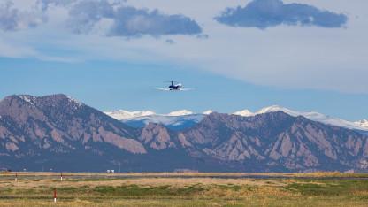
NSF NCAR Scientists Participate in Mission to Measure Air Quality Over Asia
NASA-led ASIA-AQ campaign will help verify and interpret new satellite observations

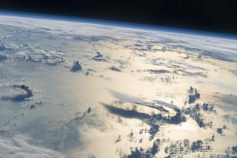
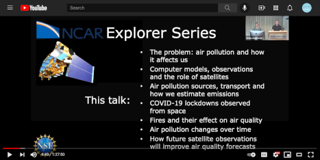
Air Quality from Space
Did you know that satellites in space can track air pollution and greenhouse gases on Earth? For the past two centuries, human activity has changed the chemical makeup of our atmosphere, leading scientists to rename this period the ‘anthropogenic epoch’.
NCAR researchers find alarming pollution in Africa
That smartphone you use, the electric vehicle you drive and your laptop all rely on lithium-ion batteries.
The material inside those batteries is cobalt, much of which is mined in Africa. New research out of Boulder suggests that mining for cobalt is also polluting parts of Africa.
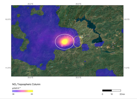
Monitoring African Copper and Cobalt Mining Emissions from Space
Emissions associated with mining operations in Africa’s Copperbelt can be quantified from space, according to new research led by the National Center for Atmospheric Research (NCAR).
Clearing the Air: The Hazy Future of Our Skies
ACOM Scientist Gabriele Pfister contributed to the new season of the award-winning podcast "Laws of Notion" which the Institute of Science & Policy just released.
Climate intervention technologies may create winners and losers in world food supply
A technology being studied to curb climate change - one that could be put in place in one or two decades if work on the technology began now - would affect food productivity in parts of Earth in dramatically different ways. (Phys.org)
Rebecca Hornbrook discusses a new era of pollution due to wildfires
From Quebec to British Columbia to Hawaii, North America is facing an extraordinary wildfire season -- and regions both near and far have found themselves increasingly blighted by smoke exposure. (France 24)
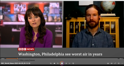
Brett Palm interviewed by BBC World News
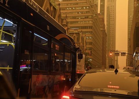
ACOM Scientist Brett Palm spoke with BBC World News correspondent Victoria Valentine about the influx of smoke from Quebec wildfires into the east coast cities of New York, Philadelphia, and Washington. Measured levels of PM2.5 were high enough to cause health concerns.
Brett Palm contributes to news coverage of wildfire smoke
Smoke from wildfires in Canada brought record-breaking air pollution to the United States this spring, creating dangerous air quality from Bismarck, N.D., to Denver and Detroit to New York City and Washington. (The Washington Post)
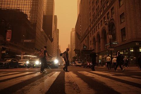
What’s actually in all that smoke you’re breathing
Billowing clouds of Canadian wildfire smoke have transformed blue skies into apocalyptic orange scenes across the eastern United States.
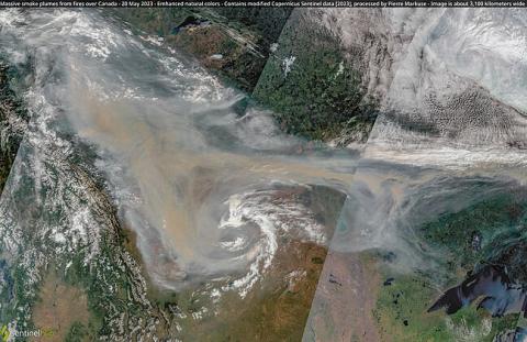
Air quality levels in parts of the U.S. plunge as Canada wildfires rage
Canada is experiencing one of the worst starts to its wildfire season ever recorded.
Rebecca Hornbrook discusses health hazards from wildfire smoke
Smoke from wildfires in Canada has engulfed the East Coast, cloaking cities in a hazy smog and putting some 100 million people under air quality alerts.
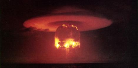
Doug Kinnison comments on wildfires harming the ozone layer
Smoke from the Canadian wildfires is once again hazing up the Front Range. Not only is it unpleasant to breathe, new research shows that smoke can erode the protective ozone layer.
9News, Denver, Colorado
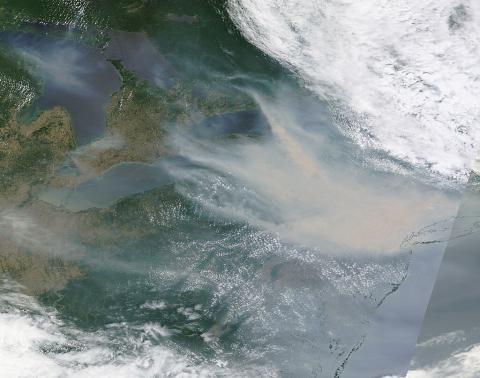
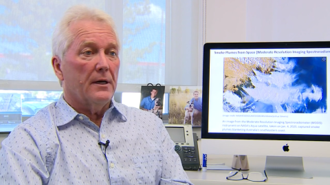
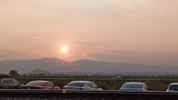
Why did Boulder, CO look like this on May 20, 2023?
Residents of Boulder, Colorado were greeted with an unwelcome visitor this week: a decline in air quality that left them with hazy skies and concerns about their well-being. The source of this phenomenon, as it turned out, lay far beyond the state borders.
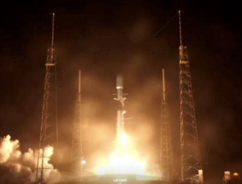
ACOM scientists celebrate launch of TEMPO satellite
David Edwards attended the launch of the TEMPO satellite instrument to monitor air quality over North America and in an article for Science magazine, Gabi Pfister commented on how TEMPO will help understand the complexity of air pollution over Colorado's Front Range.
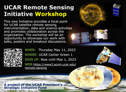
UCAR Remote Sensing Initiative Workshop
UCAR Center Green 1 Auditorium
Sign up now until May 1, 2023.
Click for more information.

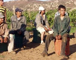
How dangerous is wildfire season for US farmworkers?
ACOM scientist Rebecca Hornbrook contributed to an article at USA Today on the impacts of wildfire smoke on agricultural workers.
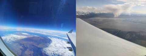
ACCLIP field campaign investigates monsoon-climate connections
During August 2022, two research aircraft will allow a team of international scientists to study how the Asian summer monsoon affects atmospheric chemistry and global climate.
Becky Hornbook comments on "ag passes" for vineyard workers during wildfires
Wildfire evacuation access permits (the so-called interim “ag passes”) were first issued in 2017 for Sonoma and Napa counties, allowing vineyard and livestock workers in Northern California to gain access during fires and other natural disasters.
How Aerosols Helped Untangle Carbon Monoxide Trends
NASA’s Terra satellite has been taking measurements of Earth’s atmosphere for more than two decades. One of the five sensors on board, Measurement of Pollution in the Troposphere (MOPITT), makes daily measurements of the air pollutant carbon monoxide.
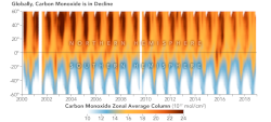
A Global Decline in Carbon Monoxide
For more than two decades, NASA’s Terra satellite has measured atmospheric concentrations of carbon monoxide (CO).
Pacific Northwest wildfires alter air pollution patterns across North America
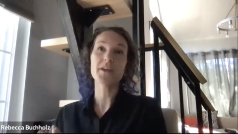
Rebecca Buchholz led a study on large and intense wildfires in the US Pacific Northwest.
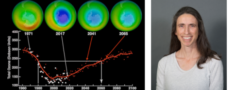
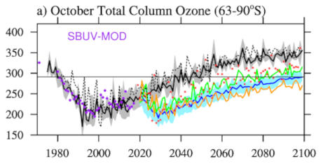
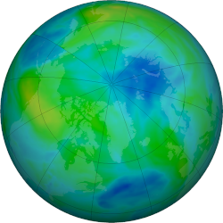
Protecting the ozone layer is delivering vast health benefits
An international agreement to protect the ozone layer is expected to prevent 443 million cases of skin cancer and 63 million cataract cases for people born in the United States through the end of this century.
How much is the wildfire smoke affecting Wyoming's air quality?
ACOM scientist Brett Palm contributed to an article in the Casper Star Tribune regarding the summer wildfires and Wyoming air quality.