Tracking air quality from high in the sky
October 21, 2015 | ACOM scientists Jerome Barre, David Edwards, and Helen Worden have demonstrated how new types of satellite data could improve how agencies monitor and forecast air quality, both globally and by region. The new satellite observations would significantly improve air pollution forecasts.
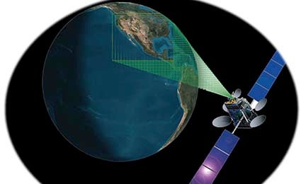
The scientists used computer simulations to test a method that combines analysis of chemistry-climate model output with the kind of data that could be obtained from a planned fleet of geostationary satellites, each of which would view a large area of Earth on a continuous basis from high orbit.
"We think the new perspective made possible by geostationary sensors would provide data that is useful for everyday air quality forecasting, as well as for early warnings about extreme events, like the effects of wildfires," said Helen Worden.
Read more at UCAR AtmosNews...