Drought-Amplified CO Emissions in Amazonia
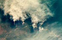
Fires in Amazonia principally occur during the dry season lasting roughly from July to October and are concentrated in the 'arc of deforestation' spanning across the southern and eastern basin margins. While much of the biomass burning activity in Amazonia follows directly from deforestation associated with agricultural practices, human-caused fires often escape from deforested areas into neighboring standing forests. These fires typically burn below the forest canopy and cause long-term damage to the ecosystem . Areas affected by these understory fires are not represented in deforestation statistics even though they are often larger than clear-cut areas. The total area burned by understory fires may be particularly extensive during droughts.
Figure 1 compares annual rates of deforestation in the Brazilian 'Legal Amazon' area (from the PRODES product available at http://www.obt.inpe.br/prodes) with the annual area in Amazonia burned in understory fires as determined by the Burn Damage and Recovery (BDR) algorithm [Morton et al., 2013]. Whereas the PRODES system relies on high-resolution Landsat imagery to detect and quantify the area converted from forest to pasture and cropland, the BDR product determines fire-damaged areas in intact and logged forests using a timeseries analysis applied to either high-resolution Landsat or moderate-resolution MODIS data. The PRODES and BDR records indicate that while deforestation has diminished steadily since 2004, areas affected by understory fires are highly variable from year to year. Understory fires were particularly extensive during 2005, 2007, and 2010, all of which were drought years for the Amazon Basin [Torres et al., 2010; Lewis et al., 2011].
Long-term monthly mean maps for MOPITT ('Measurements of Pollution in the Troposphere') CO total column based on observations from 2000 to 2013 are presented in Fig. 2. The maps indicate that, on average, CO total column amounts exhibit maxima in September in the southwestern Amazon Basin near Brazil's border with Bolivia. This region, which includes the Brazilian states of Rondonia and Mato Grasso as well as northeastern Bolivia, experienced extensive deforestation in recent decades and witnessed droughts in 2005, 2007, and 2010 [Torres et al., 2010; Lewis et al., 2011].
MOPITT CO total column data for 2010 (the most recent drought year) are presented in Fig. 3. The results are presented as monthly-mean anomalies, i.e., differences in CO total column relative to the long-term mean results as shown in Fig. 2. The anomaly maps indicate that drought-amplified emissions were first apparent in the Western Amazon Basin in August, 2010, and then shifted towards the Central and Southeastern Amazon Basin in September and October. Thus, the drought of 2010 amplified CO emissions throughout the Amazon Basin.
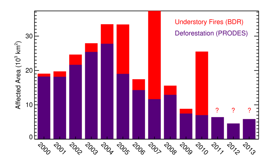
Figure 1. Annual rates of deforested area and burn-damaged area in Amazonia, as indicated by the PRODES and BDR algorithms.
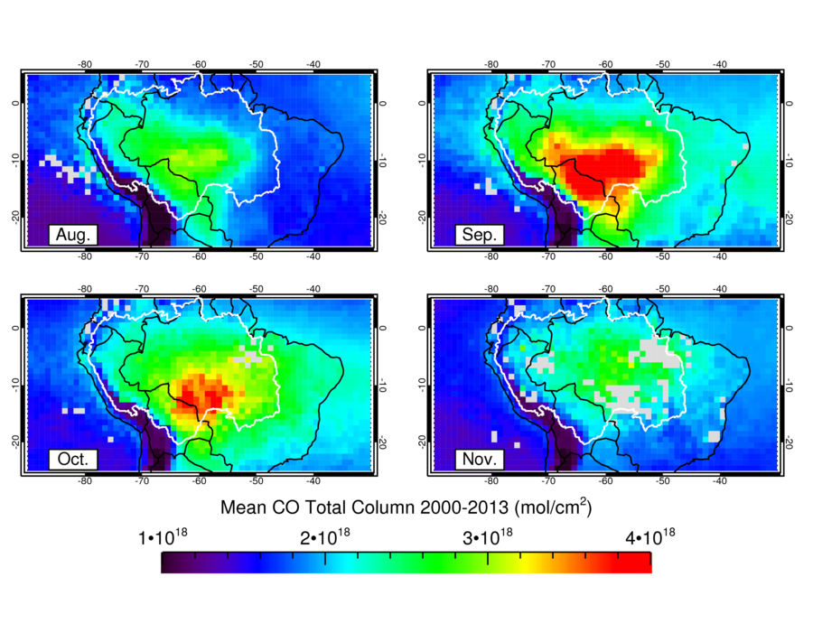
Figure 2. CO total column long-term monthly mean maps determined using MOPITT data. Boundaries of the the Amazon Basin are indicated by the solid white line.
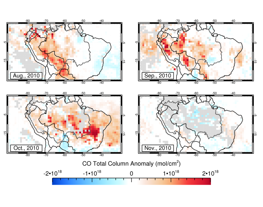
Figure 3. MOPITT CO total column monthly-mean anomaly maps for the 2010 dry season. Drought conditions affecting a vast region within the Amazon Basin resulted in amplified CO emissions first in the western Amazon Basin, and later in the central and southeastern Amazon Basin.
References
- Morton, D. C., et al., "Understorey fire frequency and the fate of burned forests in southern Amazonia," Phil. Trans. Royal Soc. B, 368, doi: 10.1098/rstb.2012.0163, 2013.
- Torres, O., et al., "OMI and MODIS observations of the anomalous 2008–2009 Southern Hemisphere biomass burning seasons," Atmos. Chem. Phys., 10, 3505–3513, 2010.
- Lewis, S. L. et al., "The 2010 Amazon Drought," Science, 2011.