Two Decades of MOPITT
The Measurements Of Pollution In The Troposphere (MOPITT) instrument, onboard the NASA/EOS/Terra satellite, was launched 18 December, 1999. The MOPITT team is an international collaboration between Canada and the U.S., with team members at the University of Toronto and Dalhousie University responsible for building and operating the instrument and the NCAR/ACOM team responsible for producing the algorithms and processing and validating the data. MOPITT measures the global, vertical distribution of atmospheric carbon monoxide, which is useful tracer of pollution from cities and large-scale fires. CO plays a key role in both air quality and climate change, so understanding how CO emissions are changing is essential for model predictions.
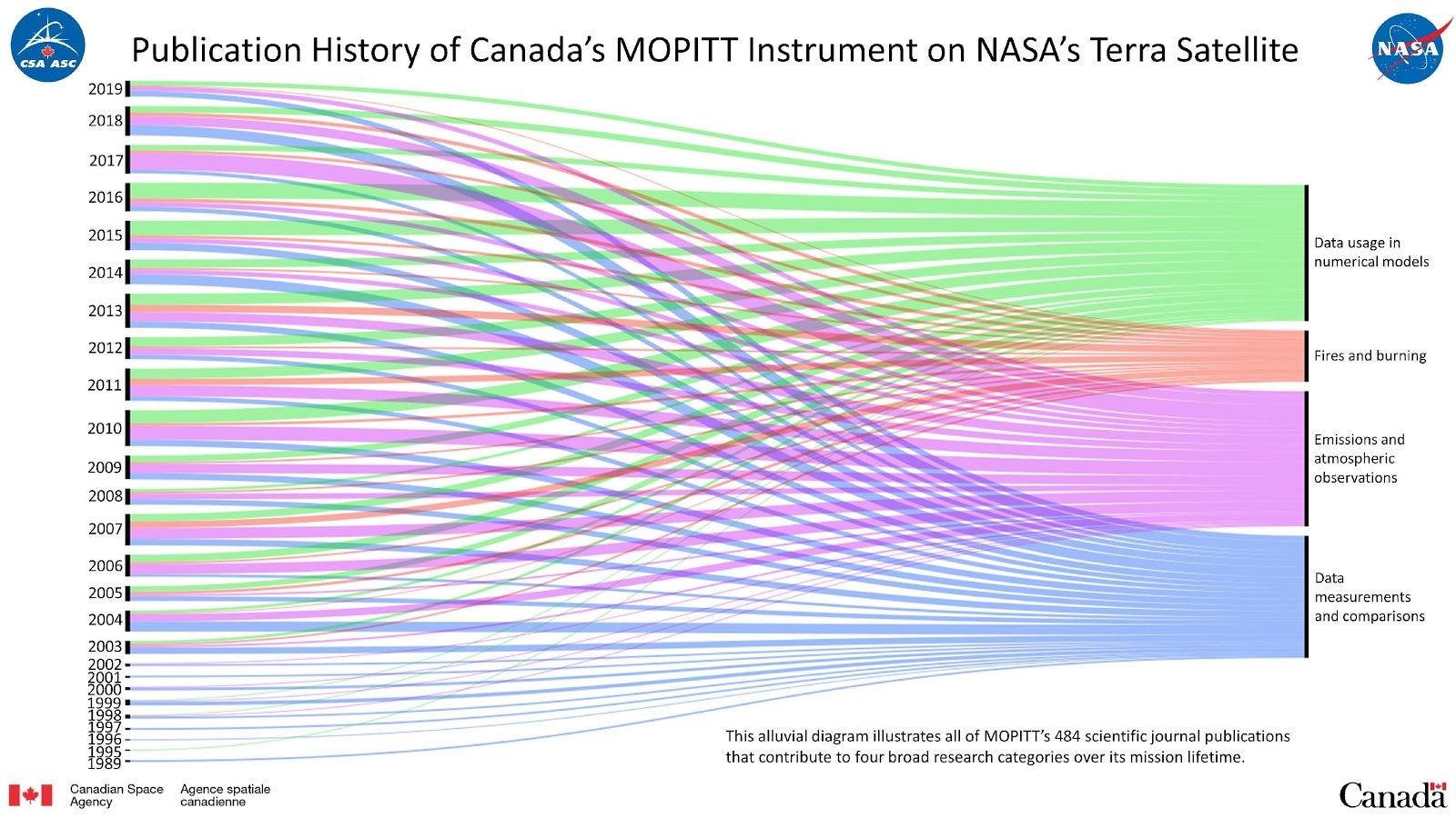
As we approach 20 years of MOPITT operations, we have been taking stock (see Figure 1) of how MOPITT data have been used to evaluate and improve chemical transport models, estimate trends in CO emissions, for understanding the different sources of other combustion products, such as aerosols and carbon dioxide and for providing data to assess the performance of new satellite observations. For example, MOPITT data are assimilated by ECMWF in CAMS (Copernicus Atmosphere Monitoring Service), which allowed an immediate post-launch check of the new CO products from TROPOMI on ESA/Sentinel-5P in 2017.

Contact
Please direct questions/comments about this page to:
Carl Drews
NSF NCAR | Research IT | ACOM